
Hiking in Santo Antao
Hike from Cova crater to green Val do Paul
Duration: approx. 4 hours
This hike starts at Covacrater and is perfect as a first hike right after arriving by ferry. At the junction, take the left path downhill and walk for about 15 minutes along the often-lying-in-the-fog-crater-floor to a turnoff on the right side of the road. From there walk up the northern crater wall. On a clear day, you will be able to enjoy a fantastic view over one of the most fertile valleys of Cape Verde – the Val do Paùl.
The descent follows an unmistakable winding path until after about an hour you reach the small village of Cabo de Ribeira. Treat yourself to a refreshment or snack at the restaurant “O Curral” on the left side of the road about 10 minutes after leaving Cabo de Ribeira. The rest of the way goes on the same paved road via Chã de Manuel Santos via Eito to the sea level Vila das Pombas.
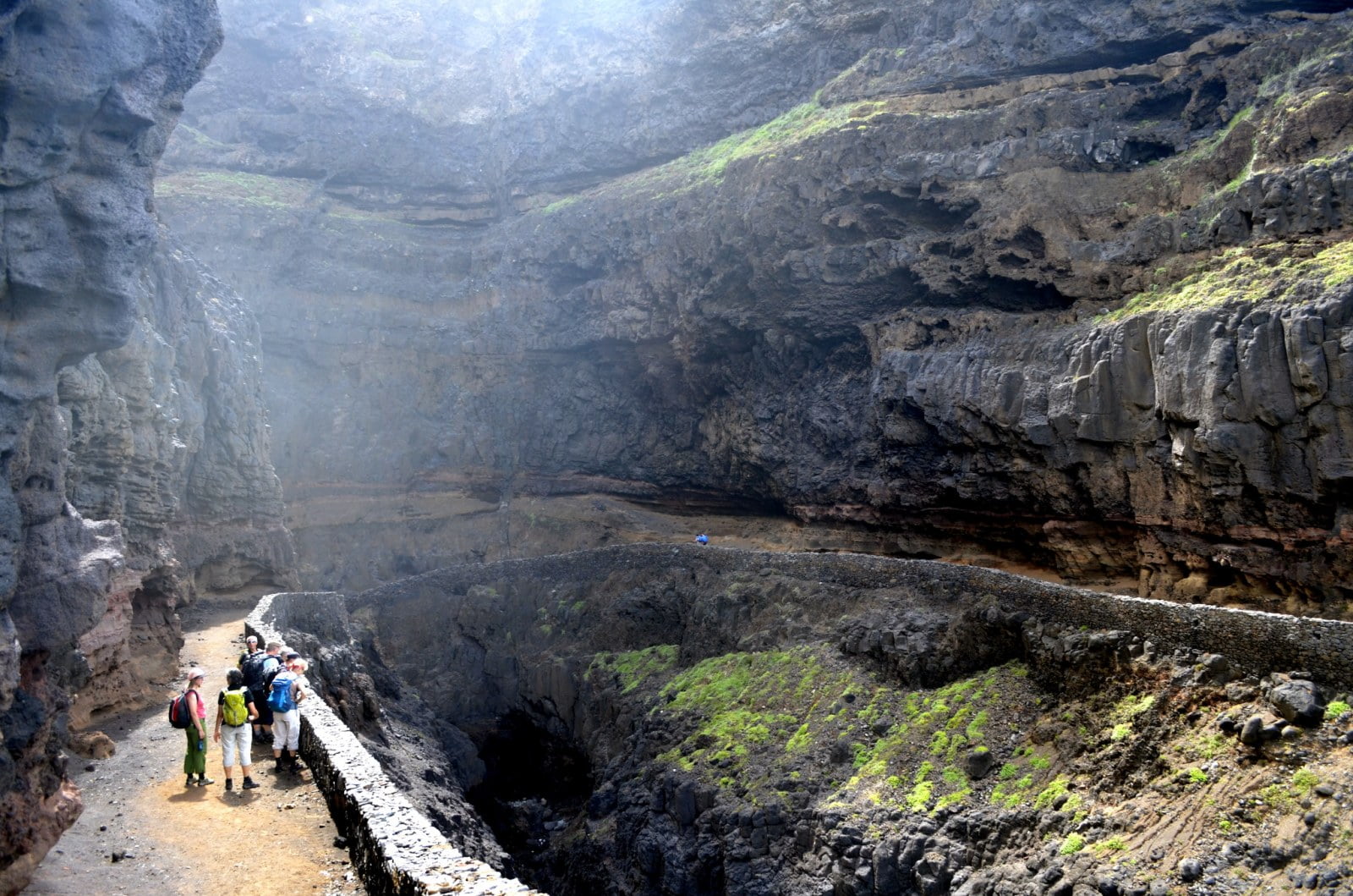
Hike from Cova crater to Pico da Cruz
Duration: approx. 2.5 hours
From the Covacrater, take the right uphill road towards the small village of Pico da Cruz. This hike offers breathtaking views both to the left and down to Vila das Pombas, as well as to the right, to the coast. On a clear day you can see the neighboring island of São Vicente. The approximately one hour way to the ridge is often wrapped in damp and cool fog. At the 1585 m high summit you can expect a breathtaking panoramic view. The way back is via the same route back to the Covacrater.
Circular hike from Chã de Morte to Bordeira de Norte
Duration: approx. 5-6 hours
This hike begins and ends in Chã de Morte. At the beginning, it goes up a fairly steep donkey path up to a plateau with spectacular views of the valley of Ribeira das Patas. The further path leads, sometimes in vertiginous heights, along the mountain slope to a point where the landscape abruptly changes to bizarre rock formations of water-storing pumice stone. This striking spot suggests that you will soon reach the great plateau, from where you can catch for the first time a view of the Tope de Coroa, the highest mountain of Santo Antão. On the plateau, the landscape changes again completely to a wide and fragrant grassland. The plateau is perfect for a longer rest break before going down to the famous serpentines of the Bordeira de Norte about one kilometer to Chã de Morte. This hike is certainly one of the most beautiful and varied walks of Santo Antão and you should have a head for heights.
Hike from Boca de Ribeiras via Chã de Pedras to Lagoa
Duration: approx. 5-6 hours
This more strenuous hike leads upwards, but the breathtaking views and ever-changing landscapes that you experience make up for any hardships. You start at a river bed in Boca da Ribeiras which you leave halfway to tackle the steep climb from Caibros to Chã de Pedras. The panoramic view that opens up on the Chã da Pedras hill is unique. The hike goes on a paved path, through partially forested area. Enormous views and narrow paths along the mountain slope change every minute. After more than an hour you get to the ridge where you are presented with a completely new landscape. The green-covered plateau that is reached after half an hour is strongly reminiscent of an European temperate zone. In the last part of this varied hike, there is a well-walked path, made of red sandstone. Through lush pine forests and larger collections of the wild-growing medical Artemisa (wormwood) you get to Lagoa, the end point of the hike.
Coastal hike from Ponta do Sol via Fontainhas to Cruzinha da Garça
Duration: approx. 5-6 hours
The hike from Ponta do Sol via Fontainhas to Cruzinha da Garça is one of the absolute highlights on Santo Antão and is considered the queen of coastal hikes. You start in the fishing village of Ponta do Sol and follow the paved road towards Fontainhas. The impressive path to Fontainhas takes about one hour and is characterized by the huge mountain slopes on its left side and steep abysses on the right. The village of Fontainhas, which seems like an eagle’s nest to hang on the mountainside, is one of the most impressive places in Cape Verde and an absolute must for every Santo Antão visitor. It is also possible to get to Fontainhas by car. The further way from Fontainhas to Cruzinha da Garça is only accessible by foot. 30 minutes after leaving Fontainhas you reach a spectacular basalt column. From here you continue along hard cobbled streets to Corvo and Forminguinhas accompanied by enormous rock formations on your left side and raging waves on your right. From Forminguinhas you continue on impressive serpentine paths to Aranhas.
The last stretch leads from Aranhas a short zig-zag way up a slightly longer flat path to the black sand beach in front of Cruzinha da Garça. This beach is not recommended for bathing. It is a known nesting place of the rare Loggerhead turtle.