
Fogo
The Fire Island
What to do
- Island Tour
- Hiking
- Trekking
What to see
- São Filipe
- Chã das Caldeiras
- Salinas de São Jorge
- Mosteiros
- Nossa Senhora do Socorro
- Igreja de São Lourenço
Geography
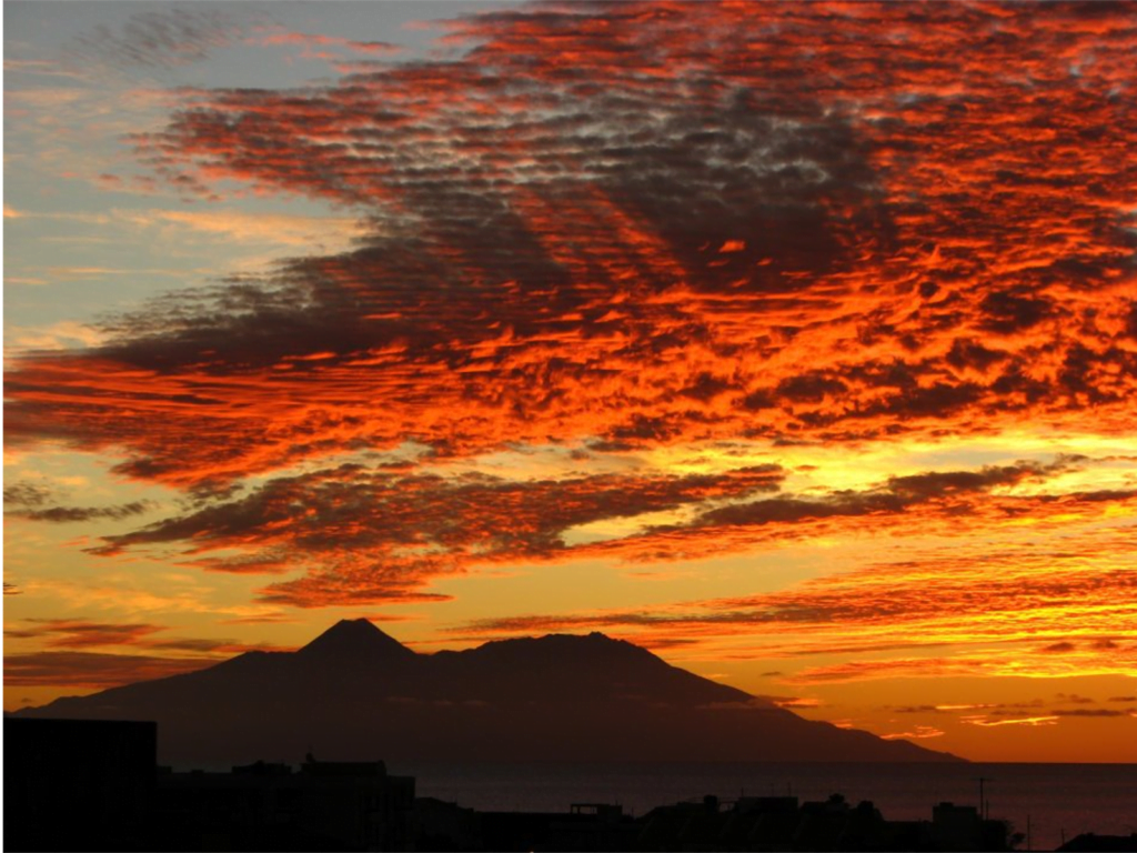
One of the southernmost islands in Cape Verde, Fogo is located between the islands of Santiago and Brava. Practically the whole island is a stratovolcano that has been periodically active: it last erupted in november of 2014. The largest volcanic feature is a nine-kilometre-wide caldera, which has walls one kilometre high. The caldera has a breach in its eastern rim and in the centre a resurgent dome with an ash cone that forms the highest point of the island: its summit is about one hundred metres higher than the surrounding caldera wall. Lava from the volcano has reached the eastern coast of the island within historical times.
Two small villages, Portela and Bangaeira, exist in the floor of the caldera (Chã das Caldeiras); the residents were evacuated during eruptions.
The island’s main city is São Filipe, near which is an airport. Fogo is largely an agricultural island. It has fertile land in the south-west with a slope of about ten to fifteen degrees. The north and the east are steeper. The island rises abruptly from the ocean, which can be as deep as 5,300 metres at a distance of five kilometres from the shoreline. The exception is to the west, where the island is connected to another seamount; further west in Brava.
The steep slopes in the north-eastern part are green and grassy all year round. The rest of the mountain is dry and barren, its dry creeks and streams are dry washes.
São Filipe’s buildings use classic Portuguese colonial architecture. Mosteiros, in the north-east, is the island’s second most important town.
Being one stratovolcano and extremely mountainous, this island has quite a diverse climate and many various microclimates. Along the coast, Fogo has a moderate dry tropical climate; higher on the slopes it has a semiarid mild tropical climate with very balanced temperatures year round; above 1,000 metres it has a cool highland subtropical steep climate. The average annual temperature on the coast is about 23-25 °C, decreasing to approximately 12-14 °C on the highest ground.
There can be remarkably cool weather in the interior, with the warmer wet season starting in July and ending in November, with the colder dry season starting in December and ending in May. Drought, the major climate risk of Cape Verdean islands, is much less pronounced on Fogo, due to the mountain’s ability to gain moisture from the clouds.
The official language of Fogo is Portuguese; yet mostly Fogo Creole is spoken. According to the 2013 national demographic census, Fogo was the fourth most populous island in the Cape Verde archipelago.
The economy of the island is based on agriculture and fishing, with coffee and wine among the main products. Due to its volcanic soil Fogo’s coffee also has a good reputation.
Tourism is steadily becoming popular. The volcano (allowed only accompanied by a local guide) is the island’s major attraction. The historic city of São Filipe and Chã das Caldeiras in the volcanic crater receive the bulk of visitors. No great tourism facilities exist, but there are small hotels, bed-and-breakfasts and local guides offer hiking tours.
There are various endemic plants on Fogo:
- Cravo-brabo (Erysimum caboverdiana)
- Língua-de-vaca (Echium vulcanorum)
- Losna (Artemisia gorgonum), a medicinal plant with a bitter taste.
- Tortolho (Euphorbia tuckeyana)
Fogo is the most prominent island of the Sotavento group of Cape Verde: it rises to nearly 3,000 metres above sea level at its summit, Pico do Fogo.
History
The prehistory of the island had a very large eruption around 73,000 years ago that collapsed the eastern side into the ocean and produced a 170 meter high mega-tsumani that struck Santiago Island.
Fogo was first sighted in 1456 by Vicente Dias along with Alvise Cadamosto and Antoniotto Usodimare. Fogo was fully discovered in 1460 by a Genovese captain António Noli on behalf of Henry the Navigator and the Portuguese Crown.
It was first called São Filipe, meaning Saint Philip in Portuguese, but
it then gained its fiery name when a madrigal “The Andalusian Merchant” by Thomas Weelkes, sang “how strangely Fogo burns, amidst an ocean full of flying fishes”.
A violent eruption, that took place in 1680, oficialized the island’s current name.
The Portuguese settled the island in 1500. Emigration started in 1850, mainly to North America. The 1910 civil revolution in Portugal drew aristocracy and large land-owners back to Portugal and left civilians behind. A small museum on Fogo explains many of these connections.
Volcanic eruptions have occurred in 1680, 1785, 1799, 1847, 1852, 1857, 1951, 1995 and 2014.
During the mid-nineteenth century, Fogo suffered from severe droughts. Death from starvation was common in the population as of 1832.
Since the beginning of the 20th century, the island has experienced a substantial diaspora. Many households live off remittances from emigrants in the U.S. and in European countries such as Portugal, France, the Netherlands and Italy. Fogo fosters strong connections to Rhode Island and to Massachusetts, US, where many people with Cape Verdean origin live.